The Project

Fieldwork | Methods | Regions | Sub projects | Field trips

About SETinSTONE

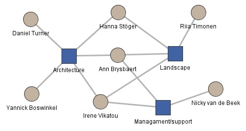
The research project seeks to investigate how human and natural resources, which interacted in the core regions of Mycenaean Greece, were employed by extant elites in order to implement their monumental building programmes. The research is carried out at the Faculty of Archaeology, Leiden University.

Duration 2015 – 2020
Contact Ann Brysbaert
Funding ERC Condolidator Grant

Research questions

  1. Why and how were building programmes executed in the core regions of the Greek mainland?
  2. Were the resources, human and other, available to carry this through?
  3. Can building to such an extent have had an impact, through exhaustion of resources, on the end of the Mycenaean civilization c. 1200 BC and, if so, what was the extent of its impact?
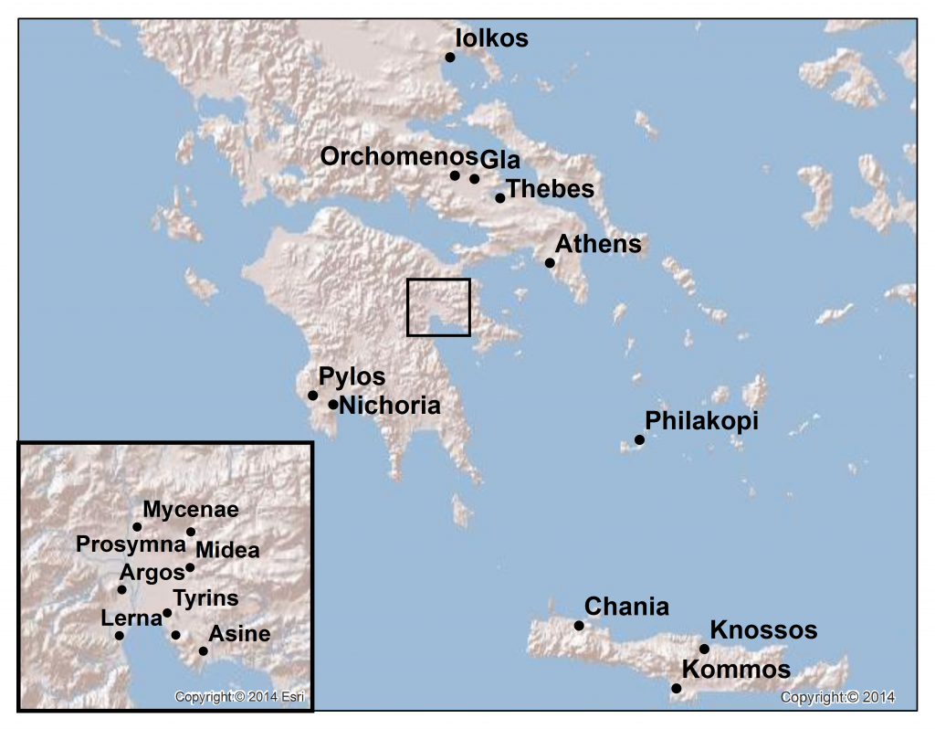
greece_map

Project description

Greek Mycenaean monumental architecture has been well-studied. However, the extent to which large-scale building programmes contributed to the socioeconomic and political changes and crises that took place in Late Bronze Age Greece (c.1600-1100 BC) has not been studied.

The project aims to investigate human and natural resources which interacted in the core regions of Mycenaean Greece. There, elites mobilized these resources to implement their monumental building programmes. It seeks to reveal how and why these constructions were accomplished, and what impact such large-scale prolonged building programmes had on the population over time. Methodologically, practical building processes and inherent social practices are captured via an interdisciplinary methodology consisting of econometric, statistic, anthropological and theoretical approaches.

This combination of approaches is novel in its scope because it brings together in a unique way the wide range of scattered data available on many aspects of human ecology and past economies of the region. As such, multi-layered data sets will illuminate the many interconnected networks of human and resource interactions that impacted on people’s day-to-day activities, first, but also on the economic, cultural and socio-political situations over time in these regions.

The analysis of the local Mycenaean phenomena shaping this period will be embedded into the wider ongoing debate of the societal ‘collapse’ indicative of the final phases of the Late Bronze Age in the East Mediterranean. More generally, this project aims to understand which role local Mycenaean phenomena played in this much larger context. As such, this project contributes in demonstrating the long-term insights archaeological research achieves in studying and understanding very human issues, and it illustrates the contemporary relevance of archaeological studies today and for the future.
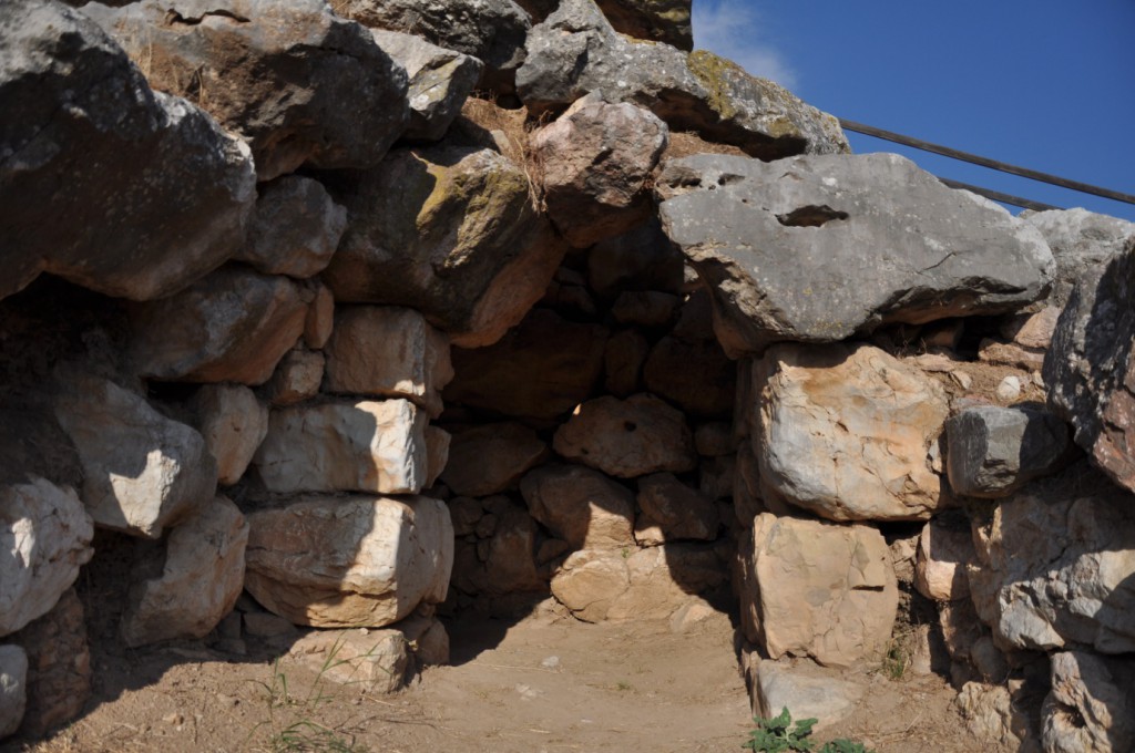
One of the room exits in the East Galleries, Tiryns (Greece)

ΤΟ ΠΡΌΤΖΕΚΤ

Το ερευνητικό έργο αποσκοπεί να εξετάσει την αλληλεπίδραση ανθρώπων και φυσικών πόρων, οι οποίοι απασχολούνταν από τις υπάρχουσες ελίτ στις κύριες περιοχές της Μυκηναϊκής Ελλάδος, ώστε να υλοποιήσουν τα μνημειακά αρχιτεκτονικά τους σχέδια. Η έρευνα διεξάγεται από το Τμήμα Αρχαιολογίας, του Πανεπιστημίου του Λάηντεν.

Διάρκεια 2015 – 2020
Επικοινωνία Ann Brysbaert
Χρηματοδότηση ERC Condolidator Grant

Ερωτήσεις Έρευνας

  1. Γιατί και πώς πραγματοποιούνταν οικοδομικά έργα στις κύριες περιοχές της ηπειρωτικής Ελλάδος;
  2. Υπήρχε διαθεσιμότητα φυσικών πόρων και ανθρώπινου δυναμικού για να υλοποιηθούν;
  3. Υπάρχει πιθανότητα η εκτενής οικοδόμηση να επηρέασε την κατάρρευση του Μυκηναϊκού πολιτισμού, γύρω στο 1200 π.Χ., εξαιτίας της εξαντλήσεως των πρώτων υλών, και αν ναι ποιό ήταν το εύρος των επιπτώσεων;

Περιγραφή του πρότζεκτ

Η ελληνική μυκηναϊκή μνημειακή αρχιτεκτονική έχει μελετηθεί εκτενώς. Ωστόσο, δεν έχει μελετηθεί ο βαθμός στον οποίο μεγάλα αρχιτεκτονικά έργα συνέβαλαν στις κοινωνικο-οικονομικές, πολιτικές αλλαγές και κρίσεις που σημειώθηκαν στην Ελλάδα την Ύστερη Εποχή του Χαλκού (c.1600-1100 π.Χ.). Αυτή η μελέτη στοχεύει να διερευνήσει την αλληλεπίδραση ανθρωπίνων και φυσικών πόρων στις κύριες περιοχές της μυκηναϊκής Ελλάδας. Οι ελίτ σε αυτές τις περιοχές, αξιοποίησαν αυτούς τους πόρους για να υλοποιήσουν τα μνημειακά αρχιτεκτονικά τους έργα. Η έρευνα, επιδιώκει να αποκαλύψει τον τρόπο και τον λόγο για τον οποίο πραγματοποιήθηκαν αυτές οι κατασκευές και τις συνέπειες που επέφεραν, με την πάροδο του χρόνου στον πληθυσμό, τα μεγάλα παρατεταμένα οικοδομικά έργα. Η πρακτική των οικοδομικών διαδικασιών και των εγγενών κοινωνικών συνηθειών, αποδίδονται μέσω μιας διεπιστημονικής μεθοδολογίας αποτελούμενη από οικονομετρικές, στατιστικές, ανθρωπολογικές και θεωρητικές προσεγγίσεις. Αυτή η συνδυαστική προσέγγιση καινοτομεί, διότι συγκεντρώνει με μοναδικό τρόπο το ευρύ φάσμα των διάσπαρτων δεδομένων, που υπάρχουν σε πολλές πτυχές της Ανθρωποοικολογίας και τις προηγούμενες οικονομίες της περιοχής. Ως εκ τούτου, τα πολυεπίπεδα σύνολα δεδομένων θα διαφωτίσουν αφενός, τα πολλαπλώς αλληλένδετα δίκτυα αλληλεπιδράσεων ανθρώπων και πόρων που επηρέασαν τις καθημερινές δραστηριότητες και αφετέρου, τις οικονομικές, πολιτιστικές και κοινωνικοπολιτικές καταστάσεις που επικρατούσαν στις περιφέρειες αυτές. Τα τοπικά μυκηναϊκά φαινόμενα που διέπουν αυτή την περίοδο, θα ενσωματωθούν στην ευρύτερη συζήτηση για την κοινωνική «κατάρρευση», ενδεικτική των τελικών φάσεων της Ύστερης Εποχής του Χαλκού στην ανατολική Μεσόγειο. Γενικότερα, η έρευνα στοχεύει να κατανοηθεί ο ρόλος που διαδραμάτισαν τα ανωτέρω, σε ευρύτερο πλαίσιο. Ως εκ τούτου, η έρευνα συνεισφέρει στη μελέτη και κατανόηση των ανθρώπινων ζητημάτων, παρουσιάζοντας τις μακροπρόθεσμες προβλέψεις που επιτυγχάνονται μέσω της αρχαιολογικής έρευνας. Επιπλέον, απεικονίζει τη σύγχρονη σημασία των αρχαιολογικών μελετών για το παρόν και για το μέλλον.
Fieldwork

Mycenean roads

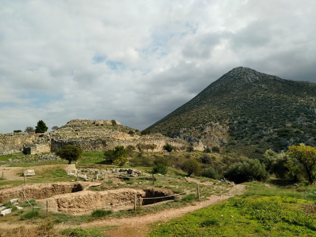
During fieldwork seasons in 2017-2019, Ann Brysbaert and Irene Vikatou have surveyed the Mycenaean landscape of the Argolid in order to verify published trajectories and architectural remains. In recording these routes with GPS, they aim to generate digitized maps exhibiting the overall Mycenaean road network in the Argolid, and analyze these using GIS software.

Mapping Mycenaean roads

Monumental architecture

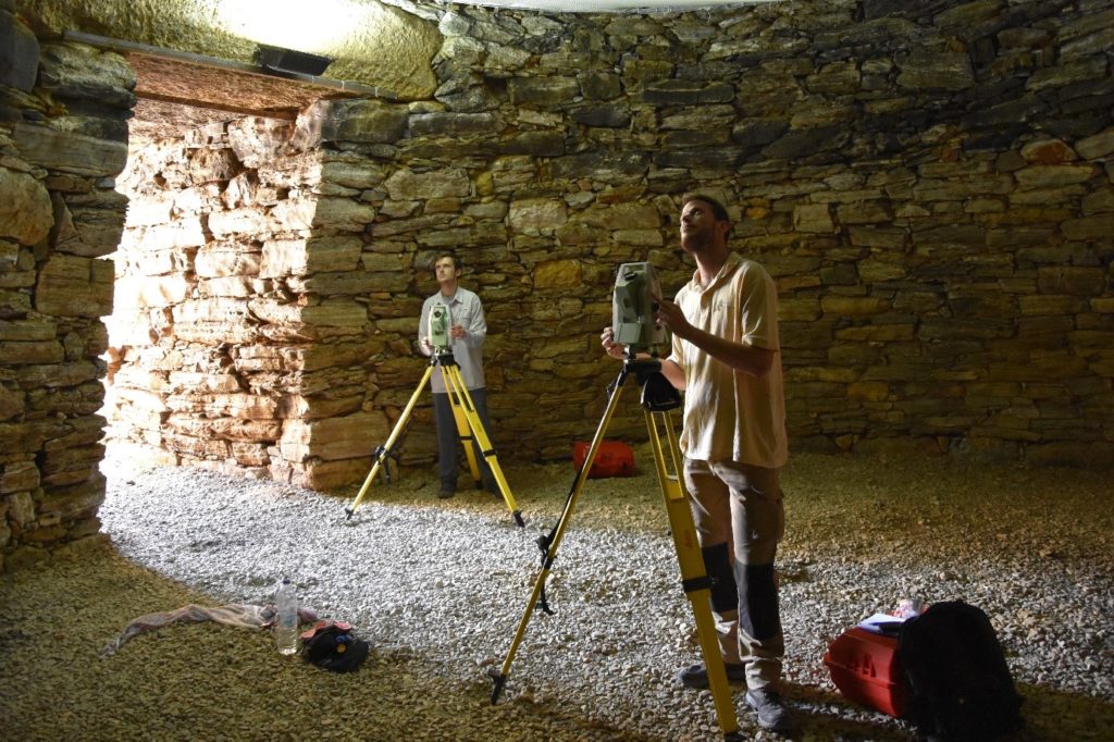
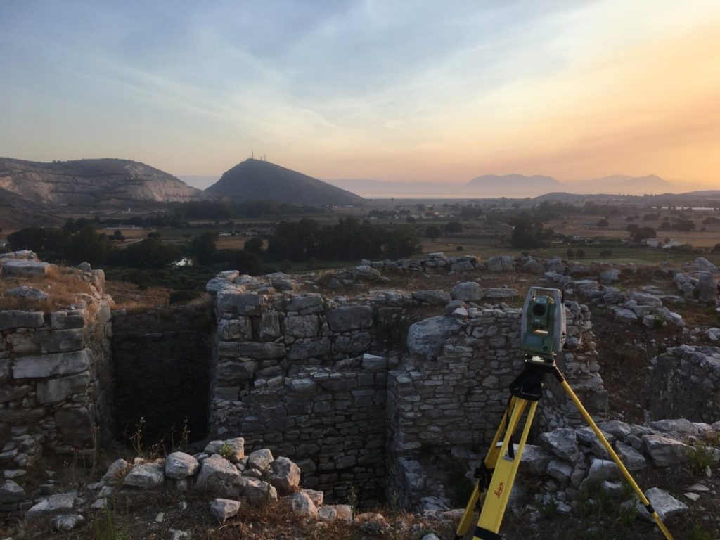
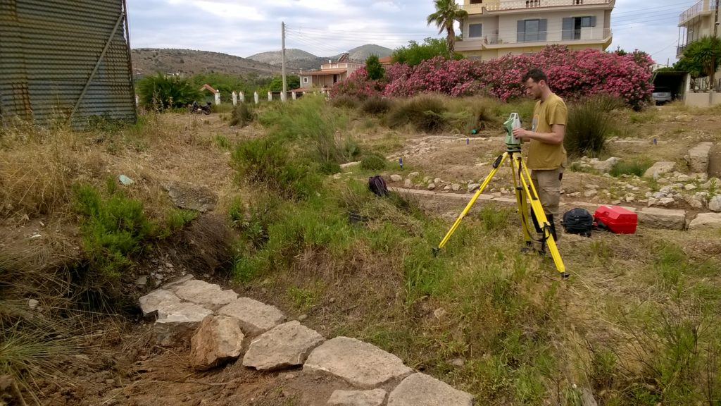
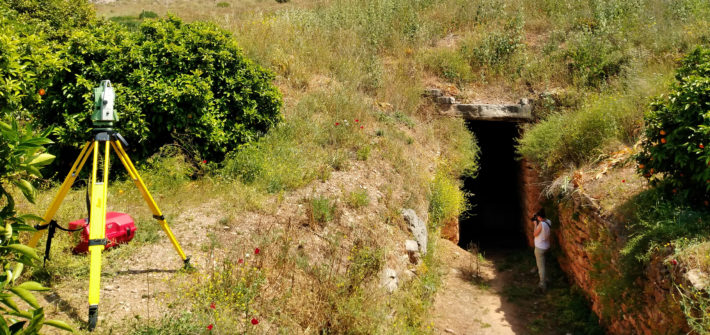
During the summers of 2016 and 2017, Yannick Boswinkel and Daniel Turner completed fieldwork for their respective PhDs on the construction of Mycenaean fortifications and multi-use tombs. At the Menidi tholos tomb north of Athens, documentation methods learned at the Salamis field school were used to record its monumental entrance passage and burial chamber built and used during the LH IIIA–B period (c. 1400–1200 BC). The following summer, sections of the Cyclopean fortification walls were recorded at the citadels of Mycenae and Teichos Dymaion, and more than 90 tombs were documented at the large Mycenaean cemeteries of Portes and Voudeni in Achaea. Photogrammetric modelling at each site allowed rapid documentation of visible architectural features that form the core of labour modelling data presented in the PhD monographs.

Daniel Turner and Yannick Boswinkel use reflectorless total station survey
to draw stones and georeference photogrammetric models
at the Menidi tholos tomb north of Athens in 2016

Dawn during fieldwork at the citadel of Teichos Dymaion in 2017

Salamis field school in 2016

In June 2016, SETinSTONE was invited to participate in the fieldwork training season on Salamis island in Greece. Salamis is best known due to its legendary naval battle which took place between the island and the mainland in 480 BC, between an alliance of Greek city states (under Athenian leadership by Themistokles) against a massive Persian fleet led by King Xerxes, and which was won victoriously by the far-outnumbered Greek troops.

The project’s initial aim was to concentrate on mapping the visible existing remains of the harbour town of ancient Salamis which is currently on dry land at Ambelakia Bay, and to find out which geophysical methods could be effectively used to record the sub-surface remains. The Salamis research team aimed to find out the location of the civic centre of the town, where the agora and the monumental buildings were and if it is possible to detect the locations of the sanctuaries mentioned by Pausanias (1.35.3 and 1.36.1)? The team also wished to discover whether the Classical town had a ‘Hippodamian’ grid design, and, if so, what the dimensions of the city blocks and the house plots were, and what the widths of streets may have been.

In order to obtain answers the practical work carried at Salamis formed the perfect training ground in the employment of the techniques also needed by several team member of SETinSTONE in order to conduct their own individual fieldwork. Therefore, the three PhD students – Ms. Riia Timonen, Mr. Yannick Boswinkel and Mr. Daniel Turner – joined students from the Finnish universities at Helsinki and Turku in both the geophysical prospection and the three-dimensional archaeological documentation training as part of the fieldwork. This fieldwork training season was financed by private donations from Finland and training funds of Dr Brysbaert’s ERC-funded project.

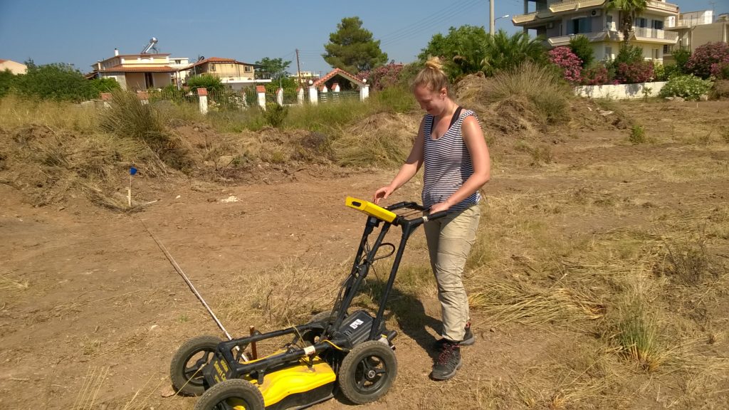
Riia Timonen at work with the Ground Penetrating Radar equipment
in the area of the West City Wall, Ambelakia

Yannick Boswinkel documenting a section of the West City Wall at Ambelakia
by means of reflectorless total station ‘drawing’

Ground penetrating radar, electrical resistivity and magnetometry techniques were tested and used in a complementary way for the geophysical prospection of the research area. Emphasis was on detailed mapping of the sub-surface features of the investigated areas and the layout of the geophysical grids was georeferenced using total stations. The geophysical prospection was directed by Dr Apostolos Sarris of the GeoSat ReSeArch Lab of the Institute for Mediterranean Studies of the Foundation for Research and Technology, Hellas. Riia Timonen was involved mainly in this work due to her prior experience with these techniques and she was able to share her knowledge with the new students on the course.

The aerial survey of the research area was carried out using a radio-controlled drone. Free satellite data was used to create an initial digital elevation model of the wider study area. All architectural surveying and documentation was fully georeferenced and was carried with total stations and photogrammetry in three dimensions. Dr. Ann Brysbaert who had experience in the employment of these methods since 2009 aided in the training of both the Leiden and the Finnish students. Especially Daniel Turner and Yannick Boswinkel were active in employing both the methods in the field and learned to use the necessary software programmes for subsequent data processing in the afternoons: the field data collected during the mornings are directly linked to GIS, CAD and photogrammetry software for further analysis immediately during the fieldwork season.

The field training at Salamis was very much hands-on and instant: this means that after a period of two weeks each participant was able to pass on the knowledge obtained to other trainees and, as such, the field training programme forms a very valuable first step in architectural and landscape documentation for all archaeologists.

The field data collected in the morning was processed in the afternoons

Methods

Building processes and social practices are being assessed via an interdisciplinary methodology consisting of econometric, statistical, computer-based, anthropological and theoretical approaches. We collate a range of varied data on human ecology and past economies to illuminate the interconnected networks of human and resource interactions that affected people’s day-to-day activities, and their wider economic, cultural and socio-political contexts.

A detailed recording of monumental buildings is required in order to study their construction and use, with the additional aim of investigating the investment necessary for such buildings. Fieldwork methods for the recording of architectural features follow the methodology described by Pakkanen with slight adjustments for site-specific circumstances (Pakkanen 2009).

Recording began by mapping a base grid of fixed points using a Leica Differential Global Positioning System with an average location accuracy of 3 cm. Two Leica total stations established a further grid of fixed points that allowed for millimetre accuracy as well as rapid station setup for movement around line-of-sight obstacles. Using the reflectorless setting, daily measurements averaged 2000-3000 points per station.

A coding program converted the total station measurements into line drawings showing the approximate outlines of measured stones or, as in the case of earthworks, point clouds showing the outlines of dromoi (tomb access corridors), burial chambers, and tumuli. AutoCAD displays the models from any angle, and the .dxf format of the files can be combined in ArcScene to create a digital reconstruction of entire sites. Agisoft PhotoScan software supplemented the total station data by creating 3D models.

The latter are based on photographs taken with a Nikon D7200 digital camera, anchored by photo points that were measured with two total stations (see figure). Based on measurements from both the AutoCAD drawings and the photogrammetry models volumes of earth and stone building materials can be calculated, which are further combined with task rates to estimate labour costs.

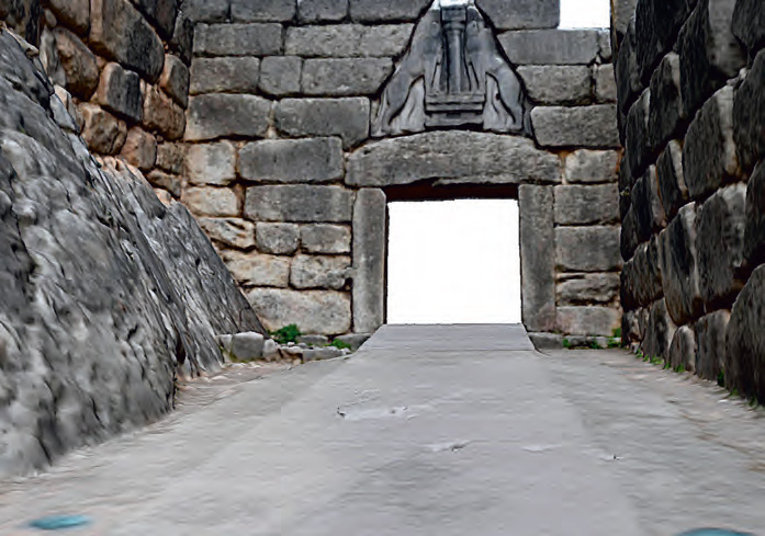
A section of a preliminary photogrammetry model of the Lion Gate at Mycenae
(image: Yannick Boswinkel).

Regions

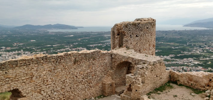
View from the Larisa Castle in Argos towards the bay of Nafplio, overlooking parts of the Argive Plain.

Map of Greece with inset of the Argolid indicating sites of importance.

Map of Greece indication the project’s fieldwork sites (black) and its collaborative projects (red).

Maps adapted from Steffen 1884 (left) and Lakovidis et al. 2003 (image by A. Brysbaert).